
After opening the Egyptian pyramids for virtual visits through Street View, Google now allows armchair tourists to virtually explore the depths of the Arabian Desert, filmed to the graceful pace of a camel.
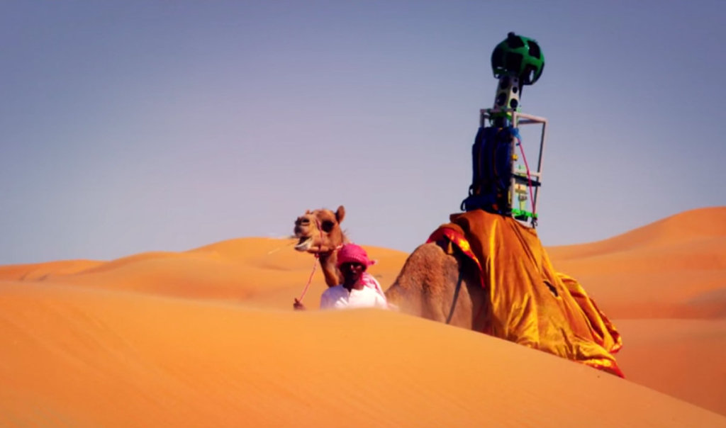
“Raffia” the camel is the first animal to carry Google’s Trekker camera, usually taken by humans to capture 360-degree images where Street View cars cannot reach. The 10-year-old camel captures images of Abu Dhabi’s Liwa Oasis, a 100 km wide yellow paradise in the UAE that boasts some of the world’s biggest sand dunes.
This way, Google Street view shows the desert as it can best be explored: on top of the lumps of a camel. “We fashioned it in a way so that it goes on a camel so that it can capture imagery in the best, most authentic and least damaging way,” Joyce Baz, spokeswoman for Google in the Middle East and North Africa told The National.
Launched in 2007, Street View compiles images from 59 countries, now also including landmarks and natural wonders, covering a distance of more than five million miles.
[youtube http://www.youtube.com/watch?v=4pVCToDTbT4]For more information: Explore the Liwa desert here, or wander around the Egyptian pyramids here.